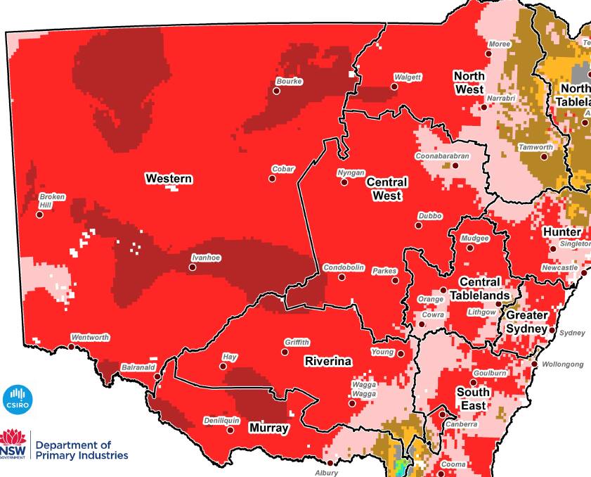
The scorching summer seasonal conditions impacted on the state’s primary producers through the third-warmest January on record.
Subscribe now for unlimited access.
$0/
(min cost $0)
or signup to continue reading
NSW Department of Primary Industries (DPI) Seasonal Conditions Coordinator
Ian McGowen said there was little relief from the record breaking heat despite January rainfall being near average across 65 per cent of the state.
“Below average rainfall was received across 21 per cent of state in areas of coastal, central and south eastern NSW,” Mr McGowen said.
“Rainfall across the state ranged from 1-404 mm, with most of NSW receiving between 10-50 mm during January.
“Thunderstorm activity provided some higher falls across the north west, northern slopes, northern tableland and the north coast.
“It was the third-warmest January on record across NSW with daytime and overnight temperatures well above average.
“Due to the above average temperatures and high evaporation experienced during January, pasture growth slowed across most of NSW.
“Topsoil moisture remained relatively low across much of inland NSW.
“Stock condition remained generally good, although in some areas the high temperatures and declining feed quality and availability resulted in stock losing condition. Supplementary feeding has recommenced in some areas.
Mr McGowen said during January the high temperatures accelerated summer crop growth and also increased crop water requirements.
“In the north, dryland crops have been stressed and yields are likely to suffer, particularly dryland sorghum and cotton,” Mr McGowen said.
“Crop development in the south remains slightly delayed due to the late sowing time. The yield potential for irrigated crops in the south is average to above average, particularly for rice and cotton.”
The Bureau of Meteorology’s rainfall outlook for February to April indicates drier than normal conditions are likely with temperatures likely to be warmer than normal.

